Book Your Stay
Lace up your shoes and hit the trails!
Last Updated: Nov 14, 2024
Ventura County Coast boasts panoramic mountain and ocean views, perfect for hiking enthusiasts. In Camarillo, Oxnard, Port Hueneme, and Ventura, there are beach and woodland hiking trails suitable for all ages. Here are our top picks!
Hiking in Camarillo
Camarillo Oak Grove County Park
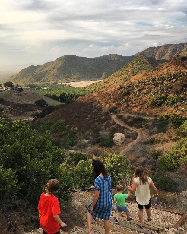
Camarillo Oak Grove County Park offers newly expanded trails for both beginners and experienced hikers. This beautiful park is dog-friendly as long as they are kept on a leash, so the entire family can experience the pastoral views of Pleasant Valley and the hills of Camarillo.
Address: 6968 Camarillo Springs Rd, Camarillo, CA 93012
📷: @venturahikers
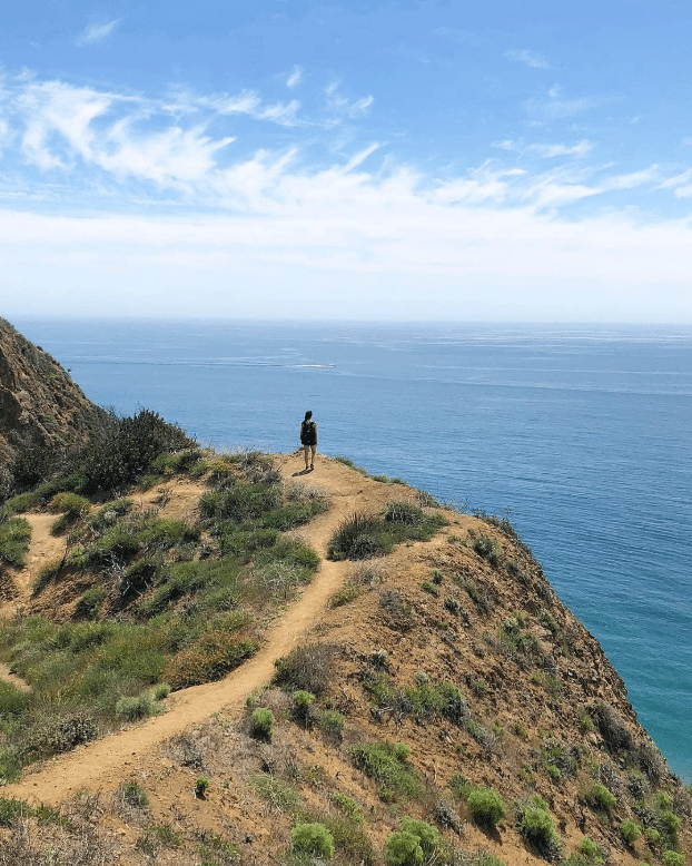
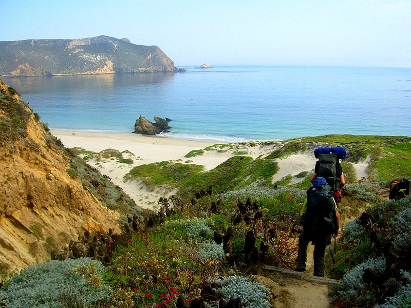
Point Mugu State Park
Avid hikers love to scale Mugu Peak in Point Mugu State Park. The cliffs tower over the Pacific Ocean. While it’s more of a strenuous trek recommended for experienced hikers, the stunning scenery and ocean vista make it worth every step! Point Mugu State Park has a large trail network that spans the entirety of the Santa Monica Mountains National Recreation Area. Here’s a few more hikes to explore while visiting.
Point Mugu State Park Hiking Trails
Grotto Trail: length: 2.8 miles, difficulty: moderate
Mugu Peak: length: 2.9 miles, difficulty: strenuous
Scenic and Overlook Trails: length: 2.7 miles, difficulty: easy
📷: @sampflem
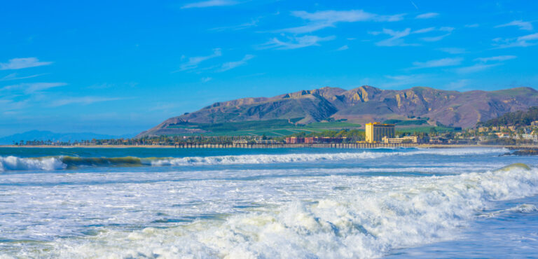
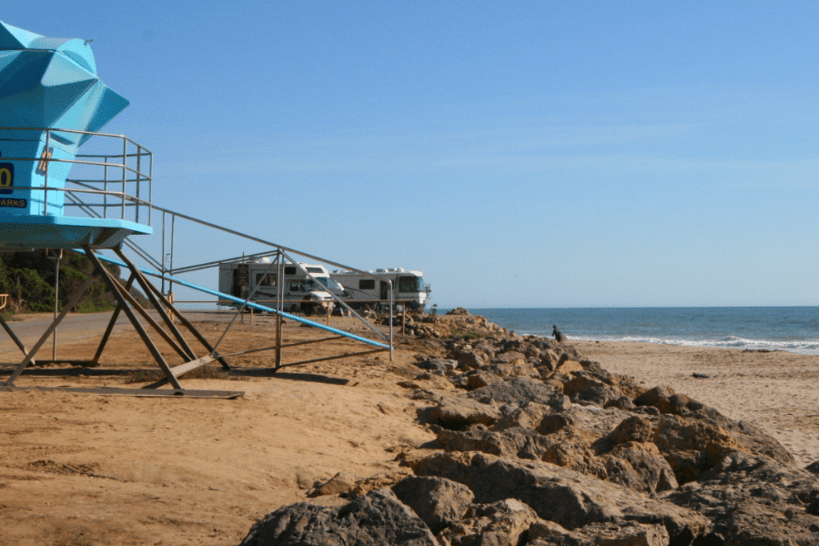
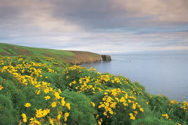
Port Hueneme Trails
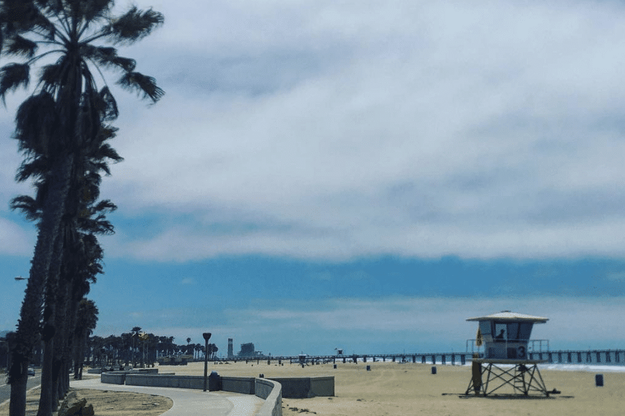
Port Hueneme Beach Trail
The Port Hueneme Beach Trail is a four-mile moderate-level trail that features beautiful wildflowers along the coast of Port Hueneme Beach during spring. It’s a great trail for bird watching or to walk during sunset, so bring your camera.
📷: @chubbysurf
Hiking in Ventura
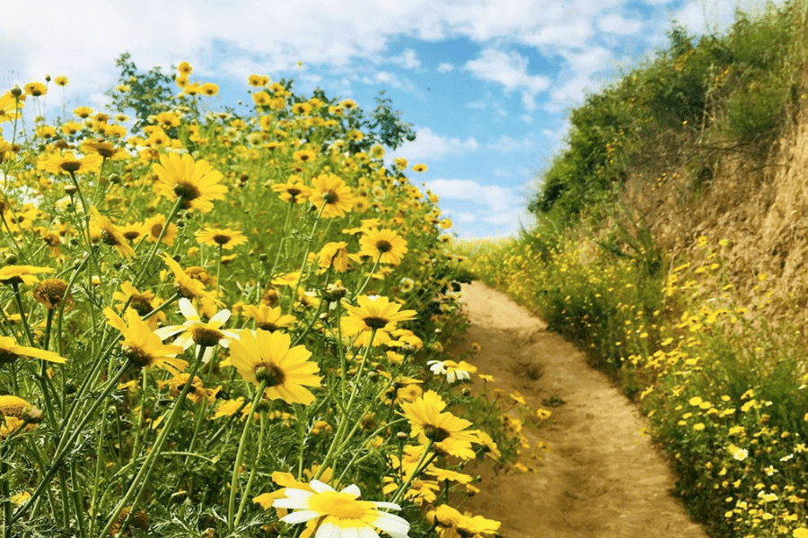
Arroyo Verde Park Loop
The Arroyo Verde Park Loop is a 2.9-mile, lightly trafficked trail located near Ventura that is rated as moderate and has lovely wild flowers in spring. Added bonus: it’s a loop trail, so there’s no way to get lost. Arroyo Verde is a popular trail primarily used for hiking, walking, and running, and is accessible year-round. Dogs are also allowed on this trail but must be kept on a leash.
📷: @welcometowanderhere
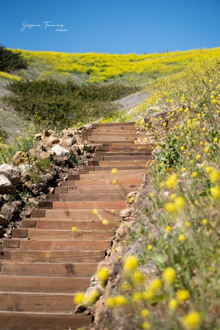
Ventura Botanical Gardens
Ventura Botanic Gardens is an easy hike with breathtaking views of Ventura County Coast, Channel Islands National Park, and the downtown Ventura. The botanic garden is an out and back trail beginning just behind Ventura City Hall and winds up to the top of Grant Park. Visit the official website for business hours, entry fees, and trail closures.
Trail Details: length: 2.1 miles, difficulty: easy
📷: Jessica Francis Photography
Harmon Canyon Preserve
Harmon Canyon Preserve is one of Ventura’s premier hiking trails boasting 2123 acres of diverse terrain to explore. Looking for spectacular ocean views? If you said yes then you can expect spectacular views of Channel Islands National Park, the Pacific Ocean, and the coast. The preserve features a series of interconnected loop trails traversing oak forests, chaparral, canyons, and ridge-lines with spectacular views. This is a great hiking trail for anyone looking for a moderately challenging hike in Ventura.
Harmon Canyon Preserve Hikes
Overlook Bench: length: 7.2 miles, difficulty: moderate
101 to Price Family Loop: length: 4.3 miles, difficulty: moderate
Harmon Canyon Road: Length: 7.1 miles, difficulty: moderate
Harmon Canyon Road to West Road: Length: 6.5 miles, difficulty: moderate
Harmon Canyon Road, 203, 101 Loop: length: 11.6 miles, difficulty: strenuous
Ocean’s Edge and River’s Edge Trails
The Ocean’s Edge and River’s Edge Trails in Ventura are located at Emma Wood State Beach, which borders both the Pacific Ocean and the Ventura River. The trails make up an easy 1.5-mile loop where you can see the beach, river, and estuary. A great choice for active families who love nature walks!
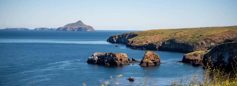
Hiking in Channel Islands National Park
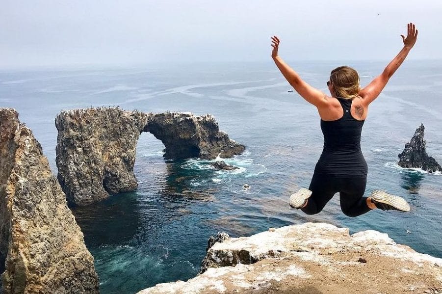
Anacapa Island
Anacapa Island, a one-hour boat ride from Ventura Harbor Village, is a great day trip for hikers looking to explore an entire island. The easy trails and stunning views make it an appealing experience for all ages. For those who want a true rustic connection with the Channel Islands.
Anacapa Island Hiking Trails
Inspiration Point: length: 1.5 miles, difficulty: Easy
Pinniped Point: length: .4 miles, difficulty: Easy
Cathedral Cove: length: .6 miles, difficulty: Easy
Lighthouse: length: .5 miles, difficulty: Easy
📷: @erikajohns0n
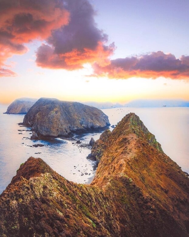
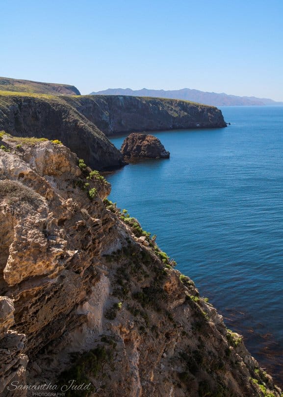
Santa Cruz Island
Santa Cruz Island is a large island with a vast trail network boasting sweeping views of the island archipelago. You can reach the island by ferry through Island Packers. The most popular hike on Santa Cruz Island is Smugglers Cove Trail, with stunning 180-degree views of the Pacific Ocean. This is a fantastic hike for those who are experienced and looking to spend the entire day outdoors and unplugged.
Santa Cruz Island Hiking Trails
Historic Ranch: length: .5 miles, difficulty: easy
Cavern Point Loop: length: 2 miles, difficulty: moderate
Potato Harbor: length: 5 miles, difficulty: moderate
Scorpoion Canyon Loop: length 4.5 miles, difficulty: moderate-strenuous
Smugglers Cove: length: 7.5 miles, difficulty: strenuous
Montañon Ridge Loop: length: 10 miles, difficulty: strenuous
Smugglers Canyon: length: 2 miles, difficulty: strenuous
Yellowbanks: length: 3 miles, difficulty: strenuous
San Pedro Point: length: 4 miles, difficulty: strenuous
Prisoners Harbor: length: .5 miles, difficulty: easy
Del Norte Overlook: length: 3 miles, difficulty: easy
Navy Road Camp: length: 7 miles, difficulty: strenuous
Del Norte Navy Road: length: 8.5 miles, difficulty: strenuous
Chinese Harbor: length: 15 miles, difficulty: strenuous
China Pines: length: 18 miles, difficulty: strenuous
Pelican Bay: length: 4 miles, difficulty: moderate-strenuous
📷: Samantha Judd
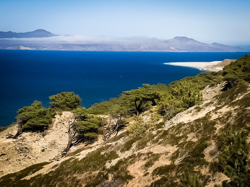
Santa Rosa Island
Santa Rosa island’s trail system offers up outstanding views of the neighboring islands and mainland. The trails on the island are either short, easy hikes, or long and strenuous treks so be sure to plan ahead.
Santa Rosa Island Hiking Trails
Campground: length: 3 miles, difficulty: easy
Water Canyon Beach: length: 3 miles, difficulty: easy
Carrington Point: length: 8 miles, difficulty: strenuous
Cherry Canyon: length: 3.5 miles, difficulty: moderate
Black Mountain: length: 10 miles, difficulty: strenuous
Torrey Pines: length: 7.5 miles: difficulty: moderate-strenuous
East Point: length: 16 miles, difficulty: strenuous
Lobo Canyon: length: 9.6 miles, difficulty: strenuous
Coastal Trail: length: 2 miles, difficulty: easy
📷:Geographer
San Miguel Island
Whether you’re looking for solitude or you’re own personal beach San Miguel Island delivers unmatched seclusion. The westernmost island in the park offers up challenging hikes with unique coastal scenery. San Miguel Island’s western location is exposed to the open ocean so be sure to bring a windbreaker and warm cap when visiting the island.
San Miguel Island Hikes
Cuyler Harbor Beach: length: 2 miles, difficulty: easy
Cabrillo Monument: length: 2 miles, difficulty: strenuous
Caliche Forest: length: 5 miles, difficulty: strenuous
Point Bennett: length: 16 miles, difficulty: strenuous
Cardwell Point: length: 6 miles: difficulty: strenuous
Lester Point: length: 5 miles, difficulty: strenuous
Crook Point Overlook: length: 5 miles, difficulty: strenuous
📷: Toddclark
Santa Barbara Island
Santa Barbara Island is the easternmost land mass in the archipelago. It’s remote location offers up some good hikes with views of Anacapa and San Nicholas Island in the distance.
Santa Barbara Island Trails
Arch Point: length: 1 mile, difficulty: moderate
Elephant Seal Overlook: length: 2.5 miles, difficulty: strenuous
Webster Point Hike: length: 3 miles, difficulty: strenuous
Sea Lion Rookery: length: 2 miles, difficulty: strenuous
Signal Peak: length: 2 miles, difficulty: strenuous
📷: Channel Islands National Park
Plan Your Visit
Find hotels in Ventura County
Get inspired with our sight seeing and activities guide
Tag your Ventura County Coast photos with #VCCVibes for a chance to be featured!